A slow-moving storm front is parked over Ohio and the wider Midwest today, dumping rain faster than the ground can absorb it and putting a long stretch of the country’s freight and manufacturing belt under flood warnings. The National Weather Service issued a flash flood warning at 5:30 a.m. today for four counties in central Ohio — Fairfield, Hocking, eastern Franklin and southwestern Licking — after morning thunderstorms brought heavy rain, with law enforcement reporting flash flooding to the weather service. More storms are expected through tonight, and the strongest are still ahead.
The Midwest and Ohio Valley, including Chicago and Cincinnati, are under an enhanced, or level 3, risk of severe thunderstorms, which has triggered numerous flood warnings and watches from Indiana into western Pennsylvania and Virginia, the weather service said. As of 7 a.m., up to 3 inches of rain had fallen in parts of Ohio.
The mechanism is simple. A slow-moving front is interacting with tropical air, and rainfall rates of 1 to 3 inches per hour are possible in the heaviest downpours. When storms keep re-forming over the same towns, the water has nowhere to go. A flood watch runs through Wednesday morning across dozens of counties in Ohio, Indiana and northern Kentucky, with several rounds of thunderstorms expected and the potential for storms to repeatedly track over the same locations.
The worst of the wind is timed for the back half of the day. The most widespread destructive winds are expected in one or two clusters of storms moving from northern Illinois into Indiana, Ohio and northeast Kentucky this afternoon and evening, with gusts topping 75 mph possible in a few spots. The tornado risk is low, but one or two are possible.
Power already going down
Utilities across the region are running restoration crews for a second straight day. Storms in the Mid-Atlantic knocked out power to nearly 175,000 homes and businesses across four states Monday night, with the bulk of the outages in Virginia, according to poweroutage.us. In northeast Ohio, Monday’s storms brought down wires and trees, forcing road closures and leaving many FirstEnergy customers without service.
For businesses, an outage of a few hours is rarely just an outage. Cold storage, food service, data rooms and any operation running a production line absorb losses that never show up in a weather report — spoiled inventory, halted shifts, and overtime to catch up once the lights come back.
A freight corridor under water
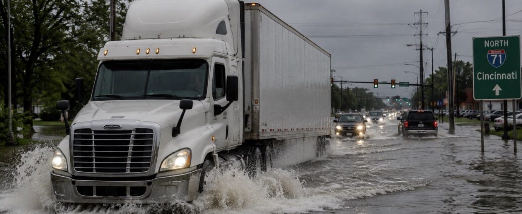
The warning zone sits on top of one of the busiest trucking corridors in the country. Interstate traffic through Indianapolis, Columbus, Cincinnati and Louisville feeds the distribution centers that supply retail across the eastern half of the United States. Flooded on-ramps and closed secondary roads slow deliveries in a way that ripples out for days, because a truck that misses a dock appointment does not simply get the next slot.
The Ohio River runs through the same footprint, and heavy runoff into its tributaries affects barge movement of coal, grain and chemicals. Farmers across Ohio, Indiana and Illinois are heading into the final stretch before harvest with fields that have already taken repeated soakings, and standing water on saturated ground does more damage to a crop than a single hard rain.
Why this week is worse than a normal storm
The ground is the problem. The flood threat zone is expected to stay largely unchanged Wednesday and Thursday, and areas already waterlogged from earlier in the week will be even more prone to flooding. Storm totals could top 6 inches where the storms hit more than once — close to double the average August rainfall of 3.43 inches in Cincinnati and 3.75 inches in Charleston, West Virginia. A level 3 of 4 threat of flooding rainfall covers Charleston, Cincinnati and the eastern side of Indianapolis.
The region has been here recently. Torrential rain on July 21 sent creeks in West Virginia to historic levels, washing out bridges and prompting numerous water rescues. Repeat flooding in the same counties raises rebuilding costs and puts pressure on property insurance in markets that were never priced as flood risk.
What to watch
The immediate question is how much rain falls between this afternoon and Wednesday morning, and whether the strongest wind clusters track over metro areas or open country. Businesses in the watch zone should assume power interruptions, plan for staff who cannot safely commute, and hold off on scheduling deliveries into the affected corridors until the front clears. The weather service repeated its standing warning to drivers not to attempt flooded roads, noting that most flood deaths happen in vehicles.
JBizNews Desk | New York
© JBizNews.com All Rights Reserved. Reproduction or distribution without written permission is prohibited.